
search
Poland elevation map
Map of Poland elevation. Poland elevation map (Eastern Europe - Europe) to print. Poland elevation map (Eastern Europe - Europe) to download. Poland average altitude is 173 m (568 ft); 75.4% of the land is less than 200 m (656 ft) above sea level. The highest point, Mount Rysy (Polish pronunciation: [ˈrɨsɨ]; German: Meeraugspitze, Hungarian: Tengerszem-csúcs) is a mountain in the crest of the High Tatras, lying on the border between Poland and Slovakia. Rysy has three peaks: the middle at 2,503 m (8,212 ft); the north-western at 2,499 m (8,199 ft); and the south-eastern at 2,473 m (8,114 ft) as its shown in Poland elevation map. The north-western peak is the highest elevation point of Poland; the other two peaks are on the Slovak side of the border, in the Prešov Region.
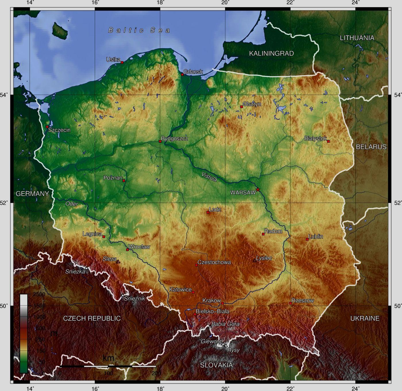
The second highest mountain group in Poland is the Beskids, whose highest peak is Babia Góra, at 1,725 metres (5,659 ft). The next highest mountain group is the Karkonosze in the Sudetes, whose highest point is Śnieżka, at 1,602 metres (5,256 ft). Among the most beautiful mountains of Poland are the Bieszczady Mountains in the far southeast of Poland, whose highest point in Poland is Tarnica, with an elevation of 1,346 metres (4,416 ft). Tourists also frequent the Gorce Mountains in Gorce National Park, whose highest point is Turbacz, with elevations 1,310 metres (4,298 ft), and the Pieniny in Pieniny National Park, whose highest point is Wysokie Skałki (Wysoka), with elevations 1,050 metres (3,445 ft). The lowest elevation point in Poland — at 2 metres (6.6 ft) below sea level — is at Raczki Elbląskie, near Elbląg in the Vistula Delta as its mentioned in Poland elevation map.