search
Poland geography map
Map of Poland geography. Poland geography map (Eastern Europe - Europe) to print. Poland geography map (Eastern Europe - Europe) to download. Poland is a country in Central Europe with an area of 312,679 square kilometres (120,726 sq mi), and mostly temperate climate as its shown in Poland geography map. Generally speaking, Poland is an almost unbroken plain reaching from the Baltic Sea in the north, to the Carpathian Mountains in the south. Within that plain, terrain variations run in bands east to west. The Baltic coast has two natural harbors, the larger one in the Gdańsk-Gdynia region, and a smaller one near Szczecin in the far northwest.
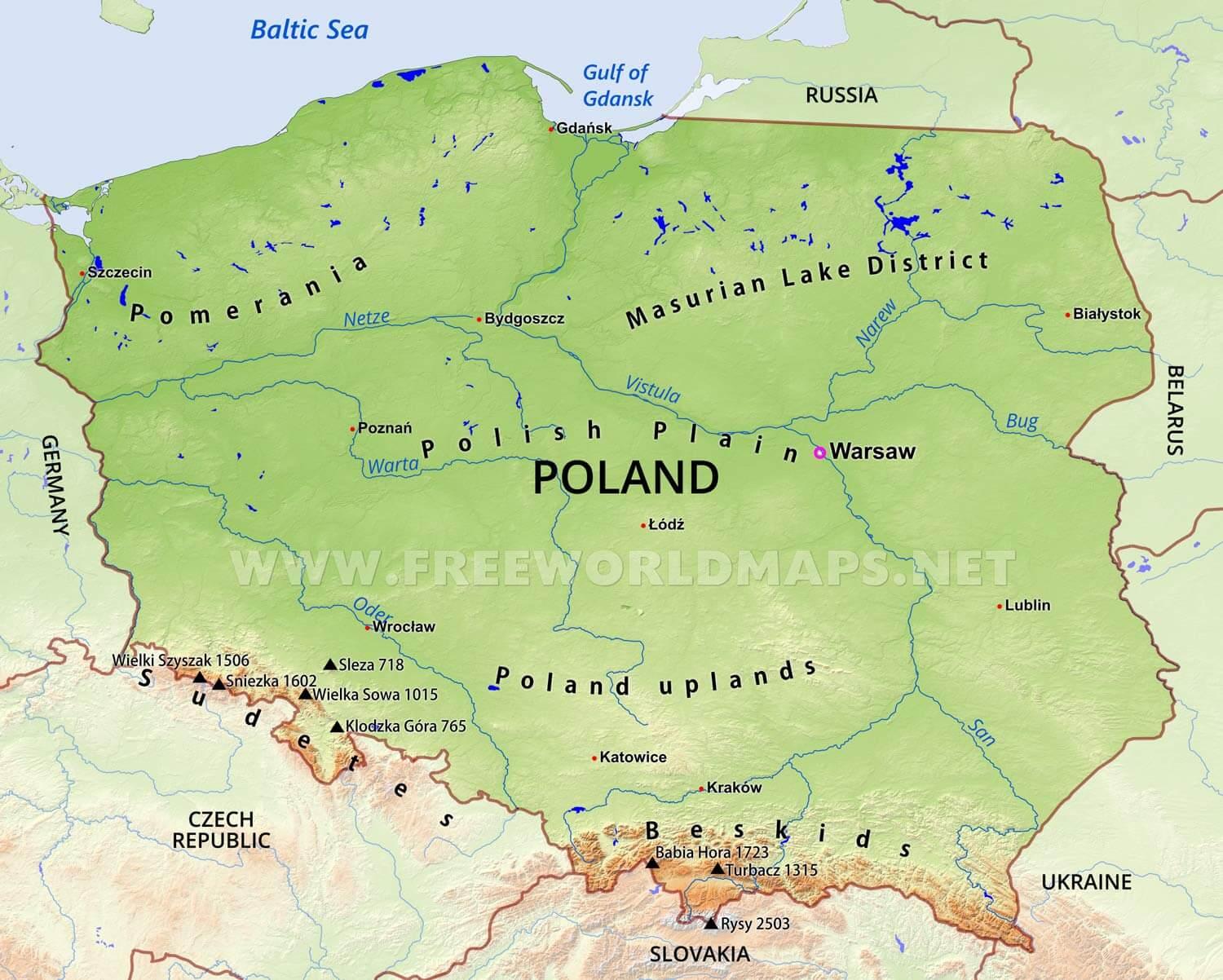
The northeastern region of Poland also known as Masurian Lake District with more than 2,000 lakes, is densely wooded, sparsely populated and lacks agricultural and industrial resources. To the south of the lake district, and across central Poland a vast region of plains extends all the way to the Sudetes on the Czech and Slovak borders southwest, and to the Carpathians on the Czech, Slovak and Ukrainian borders southeast as its mentioned in Poland geography map. The central lowlands had been formed by glacial erosion in the Pleistocene ice age. The neighboring countries are Germany to the west, the Czech Republic and Slovakia to the south.