search
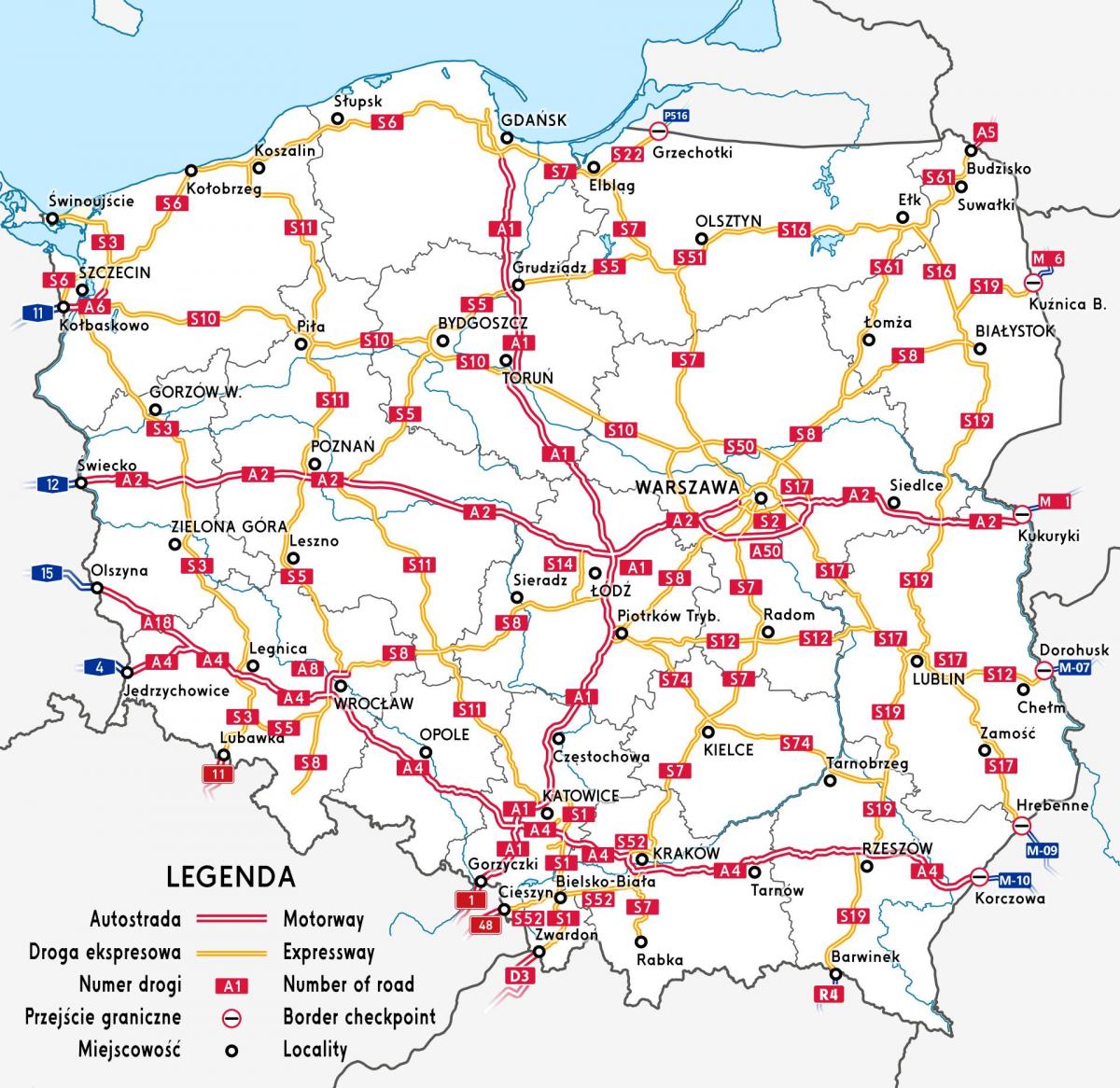
Poland highway map
Map of Poland highway. Poland highway map (Eastern Europe - Europe) to print. Poland highway map (Eastern Europe - Europe) to download. The Polish highways networks has been viewed in the past as chronically underdeveloped and lacking in basic modern infrastructure. After the fall of communism and after joining the European Union, this situation is rapidly changing for the better and in the next decade Poland plans to have a very modern network of highways as its shown in Poland highway map. Polish motorways and expressways are part of national roads network. Poland also has some two-lane and a few four-lane highways which connect all areas of the country not serviced as expressways. These are supplemented by a network of generally poorly maintained side roads and local paved routes.
Poland has already passed the halfway point in the construction of its basic network of motorways, expressways and rings. These are very expensive investments, but they provide a fast return on the investment. In some cases, the new roads pay for themselves within one year. In 2-3 years the basic network of highways will be almost fully completedas its mentioned in Poland highway map: the A1 (from north of Poland to south) and A4 (from east of Poland to west, in the southern part) motorways, almost all of the A2 (from east of Poland to west, in the central part) motorway, as well as several expressways. Only few sections of highways will be left missing before the road network is fully completed.


