search
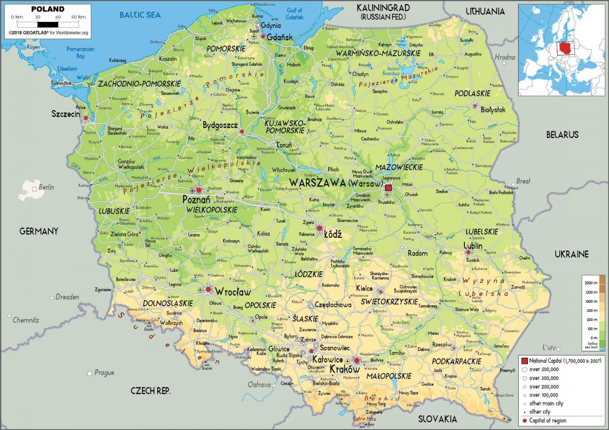
Physical map of Poland
Map of Poland physcal. Physical map of Poland (Eastern Europe - Europe) to print. Physical map of Poland (Eastern Europe - Europe) to download. Poland has a variety of striking landscapes, from the sandy beaches of the Baltic Sea coast in the north and the rolling central lowlands to the snowcapped peaks of the Carpathian and Sudeten Mountains in the south. Poland has more than 1,300 lakes throughout the country as its shown in the physical map of Poland. The terrain in the central lowlands is quite flat, and earlier glacial lakes have been filled by sediment. The region is cut by several major rivers, including the Oder (Odra), which defines the Silesian Lowlands in the southwest, and the Vistula (Wisla), which defines the lowland areas of east-central Poland. Small lakes dot the entire northern half of Poland, and the glacial formations that characterize the lake region extend as much as 200 kilometers inland in western Poland. Wide river valleys divide the lake region into three parts.
Poland lies at the physical centre of the European continent, approximately between latitudes 49° and 55° N and longitudes 14° and 24° E. In the northwest of Poland, Pomerania is located south of the Baltic coastal region and north of the Warta and Noteć rivers as its mentioned in the physical map of Poland. Masuria occupies the remainder of northern Poland and features a string of larger lakes. Most of Poland 9,300 lakes that are more than 10,000 square metres in area are located in the northern part of the lake region, where they occupy about 10 % of the surface area. The coastline of Poland was shaped by the action of the rising sea after the Scandinavian ice sheet retreated. The two major inlets in the smooth coast are the Pomeranian Bay on the German border in the far northwest and the Gulf of Gdańsk in the east.
The natural landscape of Poland can be divided broadly into three relief groups: the lowlands, the highlands, and the mountains. The eastern extremes of Poland display characteristics common to eastern Europe, but the rest of the country is linked to western Europe by structure, climate, and the character of its vegetation. The lowland characteristics predominate: the average elevation of the whole country is only 568 feet (173 metres) above sea level, while more than three-fourths of the land lies below 650 feet (198 metres) as you can see in the physical map of Poland.


