search
Poland borders map
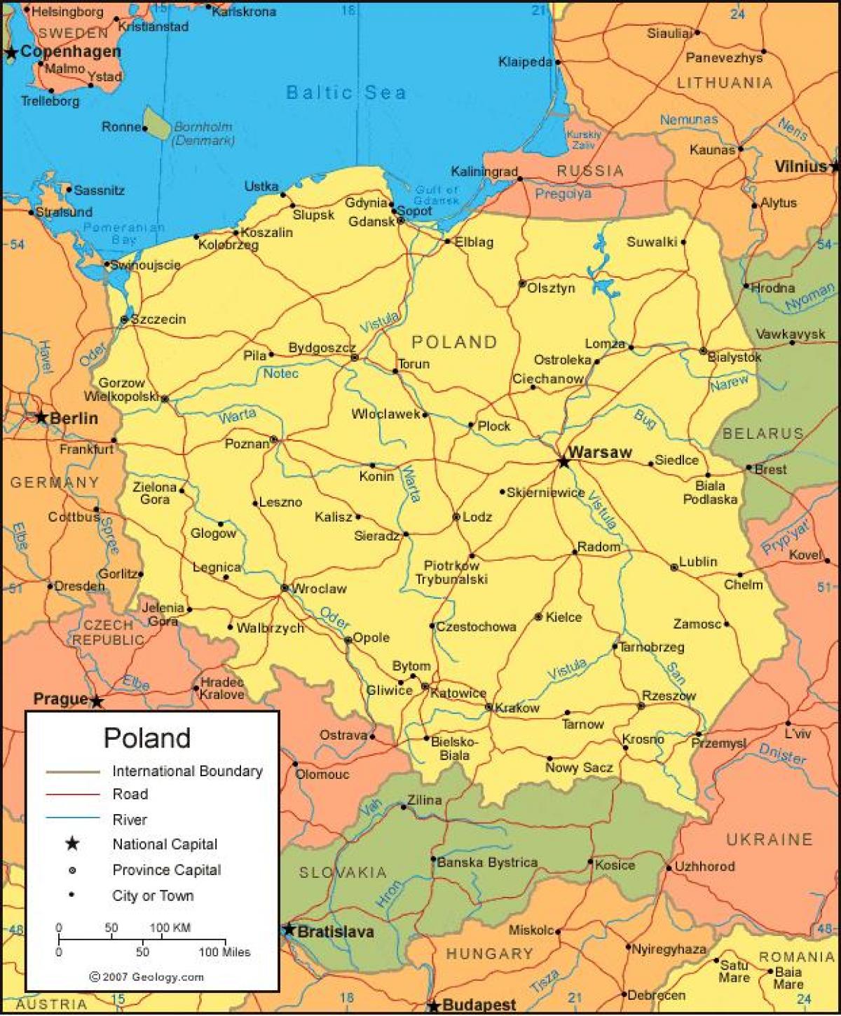
Map of Poland borders. Poland borders map (Eastern Europe - Europe) to print. Poland borders map (Eastern Europe - Europe) to download. Poland is located at the heart of the European continent. The country is a meeting place not only for cultures and ideas, but also for conflict and confrontation. Poland borders have changed many times over the centuries. Its present borders were set after World War II ended in 1945. Poland has seven neighbors as its shown in Poland borders map: Germany, Slovakia, the Czech Republic, Lithuania, Belarus, Ukraine, and Russian Kaliningrad.
The Borders of Poland are 3511 or 3582 kilometers long. Its border countries and length as its mentioned in Poland borders map: Czech Republic: 796km or 790km, Slovakia: 541km or 539km, Ukraine: 535km or 529km, Germany: 467km, Belarus: 418km or 416km, Russia (Kaliningrad): 210km, Lithuania: 104km or 103km, sea: 528km. Poland maritime claims is the exclusive economic zone defined by international treaties


