search
Poland rain map
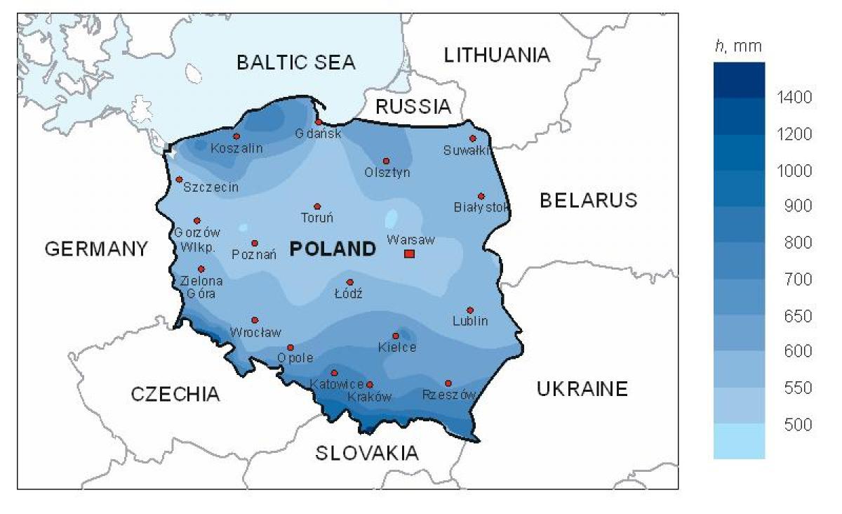
Map of Poland rain. Poland rain map (Eastern Europe - Europe) to print. Poland rain map (Eastern Europe - Europe) to download. Early autumn is generally sunny and warm before a period of rainy, colder weather in November begins the transition into winter. Winter, which may last from one to three months, brings frequent snowstorms but relatively low total precipitation. The average annual precipitation for the whole country is 600 mm (23.6 in), but isolated mountain locations receive as much as 1,300 mm (51.2 in) per year as its shown in Poland rain map. The total is slightly higher in the southern uplands than in the central plains. A few areas, notably along the Vistula between Warsaw and the Baltic Sea and in the far northwest, average less than 500 mm (19.7 in). In winter about half the precipitation in the lowlands and the entire amount in the mountains falls as snow. On the average, precipitation in summer is twice that in winter, providing a dependable supply of water for crops.
The average air temperatures amount to 6 - 8.5°C for a year, the annual rainfall is 500 - 700 mm, of which snow constitutes only 5 - 20% as its mentioned in Poland rain map. Rain and snow fall over an average of 11 days over the course of the month. You should still be prepared for a chilly weather in Poland in February, so warm clothing is a must. Warsaw, the Capital and largest city of Poland, has a humid continental climate (Köppen climatic classification Cfb or Dfb) with winters that are cold, snowy, and cloudy and moderately warm, sunny but rainy summers. Rainfall experienced in summer remains the highest of the year with an average precipitation of 71.1mm (2.8").


